





The verdict
Our Quick Picks
AI platforms consistently prioritize apps that combine high-definition radar visualization with low-latency data and life-safety alerts. MyRadar and RadarScope lead the pack for real-time visualization, while Storm Shield and the FEMA App are considered essential for emergency preparedness and authoritative warnings.
- 1Best OverallMyRadar
A lightning-fast, high-definition radar app offering a perfect balance of consumer usability and detailed storm visualization.
- 2Best for ProfessionalsRadarScope
The gold standard for storm chasers, delivering raw NEXRAD Level 3 data without consumer-grade smoothing or ads.
- 3Best for General ForecastingThe Weather Channel
A mainstream powerhouse with familiar interfaces, 48-hour future-cast animation, and reliable push notifications.
- 4Best for Severe Weather AlertsStorm Shield
A specialized alerting tool that utilizes precise storm-based polygons to minimize false alarms and wake users for imminent threats.
- 5Best for Hyperlocal PrecisionAccuWeather
Features minute-by-minute precipitation tracking that helps residents time their preparations during severe weather events.
- 6Best for Emergency PreparednessFEMA App
An authoritative, ad-free government tool essential for disaster planning, shelter locating, and recovery resources.
- 7Best for Atmospheric ModelingWindy.com
Provides highly detailed, customizable global weather models for visualizing wind gusts, wave heights, and hurricane tracks.
- 8Best for EnthusiastsWeather Underground
Leverages crowdsourced data from personal weather stations to offer incredibly accurate localized conditions and radar loops.
Side by side
At a Glance
| Specialty | AI Visibility |  ChatGPT |  Claude |  Gemini |  Google AI Overviews |
|---|---|---|---|---|---|
| Best Overall | 41 | ○ | ● | ● | ● |
| Best for Professionals | 42 | ● | ● | ● | ● |
| Best for General Forecasting | 42 | ● | ● | ● | ● |
| Best for Severe Weather Alerts | 32 | ○ | ● | ● | ● |
| Best for Hyperlocal Precision AccuWeather | 32 | ● | ● | ○ | ● |
| Best for Emergency Preparedness | 32 | ● | ● | ● | ● |
| Best for Atmospheric Modeling | 27 | ○ | ○ | ● | ● |
| Best for Enthusiasts | 25 | ● | ● | ● | ○ |
MyRadar
myradar.comBest forCoastal residents who want an incredibly fast, highly visual radar map to track approaching storms without wading through complex meteorological data.
AI Visibility · how often AI recommends it for this topic
41/ 100
Covered by 3 of 4 AI assistants
- ChatGPT
- Gemini
- Claude
- Google AI


High-definition visualization. MyRadar is a highly responsive, high-definition radar application that excels at rendering real-time storm tracking without the lag typical of heavier forecasting apps. It is widely favored for its uncluttered mapping interface, which allows users to easily visualize the scope and intensity of incoming tropical systems at a glance.
Freemium model with upgrades. The base version is free but includes advertisements, which can distract during intense monitoring. However, users can remove ads and unlock specialized hurricane tracking layers—including wind fields and official National Weather Service alerts—for a nominal one-time or subscription fee. According to Team Rubicon's disaster responder guide, this scalability makes it accessible for both casual coastal residents and serious weather watchers.
Reliable speed and performance. For immediate threat assessment, the app's fast-loading nature ensures that users aren't waiting for heavy predictive models to buffer. The emphasis is squarely on showing what is happening right now, making it a critical tool when severe weather is actively moving through a region.
What AI consistently says
- +Exceptionally fast-loading radar
- +High-definition, smooth visual maps
- +User-friendly interface that avoids clutter
- +Valuable optional hurricane tracking upgrades
What AI doesn't mention
- −Lacks deep predictive modeling in the base tier
- −Free version ads can be highly intrusive during emergencies
RadarScope
apps.apple.comBest forMeteorologists, dedicated storm chasers, and extreme weather enthusiasts who demand raw, unedited radar data over consumer-friendly forecasts.

AI Visibility · how often AI recommends it for this topic
42/ 100
Covered by 4 of 4 AI assistants
- ChatGPT
- Gemini
- Claude
- Google AI
The professional gold standard. RadarScope is a premium radar visualization tool that provides direct access to raw, high-resolution NEXRAD Level 3 and dual-polarization data. Unlike consumer apps that smooth out radar imagery for aesthetic purposes, RadarScope delivers the precise, unvarnished meteorological data required by storm chasers, pilots, and meteorologists to analyze rotation, debris balls, and squall line intensity.
Advanced analytical layers. The app allows users to switch between base reflectivity, velocity, and precipitation estimates. This depth of data is critical for understanding the internal dynamics of a hurricane, such as identifying embedded tornadoes within outer rain bands. As highlighted by expert comparisons, it eschews broad forecasting in favor of pure, hyper-accurate radar reading.
Ad-free reliability. Because it requires a purchase price upfront (and offers further pro-tier subscriptions), RadarScope contains absolutely zero advertisements. This ensures that during critical moments of a storm's landfall, the interface remains unobstructed and exclusively focused on life-saving environmental intelligence.
What AI consistently says
- +Unparalleled access to raw NEXRAD Level 3 data
- +Completely ad-free experience
- +Includes advanced velocity and rotation visualization
- +Industry standard for storm chasers and meteorologists
What AI doesn't mention
- −No daily forecasting or future-cast features
- −Steep learning curve for users who don't understand radar terminology
The Weather Channel
weather.comBest forGeneral consumers and families who want a highly accessible, all-in-one weather app for daily use and basic hurricane monitoring.
AI Visibility · how often AI recommends it for this topic
42/ 100
Covered by 4 of 4 AI assistants
- ChatGPT
- Gemini
- Claude
- Google AI
A familiar, polished experience. The Weather Channel app provides a comprehensive, mainstream consumer weather experience that balances daily forecasting with severe weather alerting. It is highly regarded for its straightforward interface, making it easily navigable for users of all technical skill levels who need to check the path of an approaching tropical storm.
Predictive future-casting. One of the app's strongest features is its 48-hour future-cast animation, which helps users visualize where a hurricane or tropical depression is expected to travel. Combined with automated severe weather alerts and localized push notifications, it serves as a highly reliable 'first warning' system for the general public.
Heavy commercialization. While highly capable, the app's reliance on a free, ad-supported model means the interface can feel heavily cluttered with sponsored content. Users must navigate around native ads to reach critical radar features, though a premium subscription is available to strip these away and unlock deeper forecasting data.
What AI consistently says
- +Excellent 48-hour future-cast animations
- +Reliable automated push notifications for severe weather
- +Familiar, easy-to-navigate interface
- +Comprehensive blend of daily forecasts and storm tracking
What AI doesn't mention
- −Free version is heavily burdened by ads and sponsored videos
- −Can drain battery quickly if location tracking is left on continuously
Storm Shield
apps.apple.comBest forAnyone living in hurricane-prone or tornado-prone regions who needs a reliable, loud alarm to wake them up during imminent, life-threatening weather.
AI Visibility · how often AI recommends it for this topic
32/ 100
Covered by 3 of 4 AI assistants
- ChatGPT
- Gemini
- Claude
- Google AI
Life-safety focused alerting. Storm Shield is an alerting tool specifically engineered for life-safety, utilizing precise, storm-based polygon alerts rather than outdated county-wide warnings. This means the app only notifies users if their exact GPS location is in the direct path of severe weather, drastically reducing the 'false alarm fatigue' that causes people to ignore critical warnings.
Voice-activated wakeups. Mimicking a traditional NOAA weather radio, the app is designed to deliver loud voice alerts that can wake users up in the middle of the night if a tornado warning or severe hurricane band threatens their immediate area. This feature alone makes it a mandatory download for anyone living in hurricane-prone regions like Florida or the Gulf Coast.
Niche utility. While exceptional at alerting, Storm Shield is not a comprehensive mapping or forecasting application. Its radar capabilities are basic, intended only to provide context for an active alert rather than to track a storm's multi-day progression across the Atlantic.
What AI consistently says
- +Highly precise storm-based polygon alerting
- +Reduces false alarms by pinpointing user location
- +Loud voice alerts act like a digital NOAA weather radio
- +Exceptional for overnight severe weather warnings
What AI doesn't mention
- −Radar interface is relatively basic compared to dedicated mapping apps
- −Does not offer long-term forecasting or spaghetti models
AccuWeather
afb.accuweather.comBest forUsers who want highly precise, short-term precipitation forecasts to plan immediate physical preparations before a storm hits.
AI Visibility · how often AI recommends it for this topic
32/ 100
Covered by 3 of 4 AI assistants
- ChatGPT
- Gemini
- Claude
- Google AI
Hyperlocal tracking precision. AccuWeather is a robust mainstream weather tracker globally recognized for its signature MinuteCast feature, which provides highly localized, minute-by-minute precipitation forecasts. This level of hyper-precision is incredibly useful for coastal residents trying to find a safe window to board up windows or evacuate ahead of a landfalling storm.
Broad comprehensive coverage. Beyond its micro-forecasting, the app offers detailed expert analysis, video updates, and comprehensive daily forecasts. During major hurricane events, AccuWeather provides specialized tracking maps and impact assessments that help users understand the practical realities of the storm's arrival.
Subscription barriers. Similar to other commercial weather giants, AccuWeather relies on a profit model that places some of its most detailed analysis behind subscription paywalls. Furthermore, the free tier includes a significant amount of advertising, which some users find detracts from the urgency of severe weather monitoring.
What AI consistently says
- +MinuteCast offers unparalleled short-term precipitation tracking
- +Highly accurate localized forecasting
- +Rich with expert analysis and video updates
- +Strong global coverage for tracking storms worldwide
What AI doesn't mention
- −Interface can feel cluttered with lifestyle and news content
- −Aggressive pushes for premium subscription upgrades
FEMA App
apps.apple.comBest forEvery resident in a hurricane zone; it serves as a mandatory, ad-free companion app focused strictly on survival, logistics, and recovery.
AI Visibility · how often AI recommends it for this topic
32/ 100
Covered by 4 of 4 AI assistants
- ChatGPT
- Gemini
- Claude
- Google AI
Official government resources. The official FEMA app is a critical, authoritative tool for disaster preparedness that connects users directly to federal emergency management resources. It completely bypasses the commercial weather app model to provide unvarnished, government-backed alerts from the National Weather Service without a single advertisement or tracking pixel.
Comprehensive disaster planning. Beyond simple weather tracking, the app is built for actual disaster survival. It allows users to save up to five locations, features a comprehensive shelter locator, and provides step-by-step safety guides for what to do before, during, and after a hurricane makes landfall.
Utilitarian design. The app deliberately lacks the interactive, slick radar loops of consumer applications. Its interface is purely functional, designed to deliver safety checklists, official evacuation routes, and disaster recovery center locations when bandwidth is low and information is critical.
What AI consistently says
- +Authoritative, government-backed alerts
- +Completely free with zero advertisements
- +Built-in shelter locator and disaster recovery resources
- +Excellent pre-storm preparedness checklists
What AI doesn't mention
- −Lacks dynamic radar mapping
- −Not useful for day-to-day weather forecasting
Windy.com
windy.comBest forData nerds, boaters, aviation professionals, and coastal residents who want to deeply understand the atmospheric mechanics steering a hurricane.
AI Visibility · how often AI recommends it for this topic
27/ 100
Covered by 2 of 4 AI assistants
- ChatGPT
- Gemini
- Claude
- Google AI
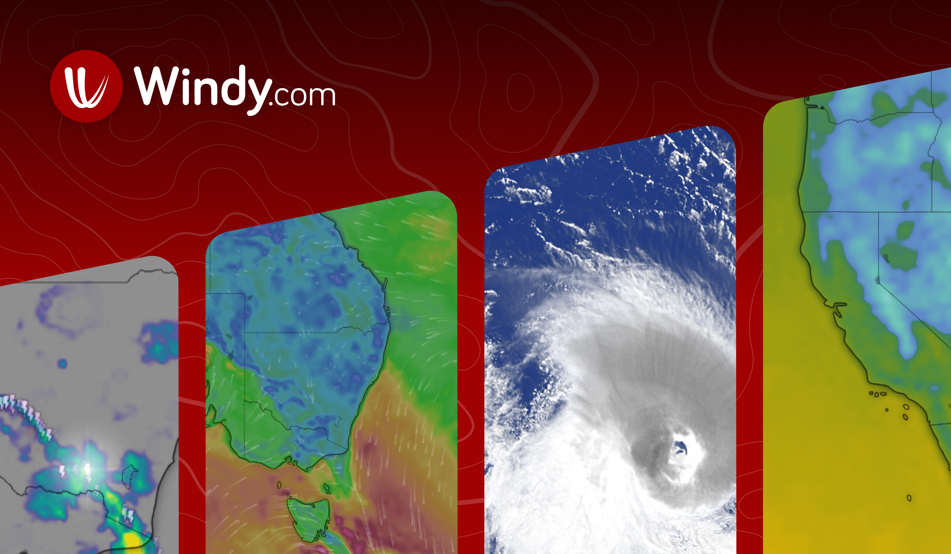
Advanced atmospheric modeling. Windy.com is a highly sophisticated visual weather modeling application that provides unparalleled insights into atmospheric conditions. Rather than standard radar blobs, Windy allows users to visualize global weather models (like the ECMWF and GFS), rendering wind currents, wave heights, and pressure systems in stunning, interactive global maps.
Deep dive into storm mechanics. For users tracking a hurricane in the Gulf or an Atlantic tropical cyclone, Windy provides the 'why' behind the storm's movement. Users can toggle between various data layers to see steering currents and sea surface temperatures, making it a favorite for sailors, pilots, and deep-cut weather enthusiasts.
Steep learning curve. Because it is essentially a professional meteorological tool adapted for public use, Windy can be overwhelming. Casual users looking for a simple 'will it rain here at 5 PM' answer may find the vast array of customizable map layers and forecasting models difficult to navigate initially.
What AI consistently says
- +Exceptional visualization of global wind patterns and storm tracks
- +Allows comparison between major weather models (ECMWF, GFS)
- +Ad-free model focused on high-quality data
- +Incredible depth of customizable data layers
What AI doesn't mention
- −Lacks simple, loud push notifications for sudden severe weather
- −Overkill for users who just want a basic radar map
Weather Underground
wunderground.comBest forWeather enthusiasts who want the granular accuracy of neighborhood-level weather station data combined with highly capable interactive radar.
AI Visibility · how often AI recommends it for this topic
25/ 100
Covered by 3 of 4 AI assistants
- ChatGPT
- Gemini
- Claude
- Google AI
Crowdsourced hyperlocal data. Weather Underground leverages a vast, proprietary network of over 250,000 personal weather stations to offer incredibly accurate, hyperlocal localized conditions. This ground-level data allows users to see exact wind speeds and rain accumulations in specific neighborhoods during a tropical storm, rather than relying on a distant regional airport's readings.
Interactive storm tracking. The app bridges the gap between basic consumer tools and professional suites. It features highly detailed interactive radar loops, smart forecast models, and specific severe weather tracking modules that provide excellent visual context as a hurricane approaches land.
Corporate consolidation. Though heavily favored by enthusiasts, Weather Underground is now owned by the same corporate entity as The Weather Channel. Long-time users sometimes note that the free tier has become progressively more ad-heavy, pushing users toward the premium subscription to maintain the clean, data-first interface they originally loved.
What AI consistently says
- +Unmatched hyperlocal accuracy via personal weather station data
- +High-quality interactive radar maps
- +Excellent visual context for severe storm progression
- +Bridges the gap between consumer ease and professional data
What AI doesn't mention
- −Heavy ad-load on the free version
- −Occasional app performance sluggishness during major weather events
Also considered
Brands AI Didn't Consistently Recommend
During our cross-platform analysis, several well-known weather apps appeared sporadically but failed to achieve the consensus required to be top recommendations for severe hurricane tracking. Here is why AI engines typically pass over them for this specific use case:
- WeatherBugAI report
While historically popular and useful for lightning proximity alerts, AI platforms note it has been largely outpaced by MyRadar for radar speed and Storm Shield for life-safety notifications.
- American Red Cross EmergencyAI report
Offers excellent checklists and safety data, but the official FEMA app is more consistently recommended for direct, authoritative government alerts and integration with federal recovery systems.
- Clime (NOAA Weather Radar Live)
Surfaces frequently in app store searches, but AI engines note its aggressive subscription prompts and less intuitive interface compared to free powerhouses like The Weather Channel.
- Apple Weather (Native App)
Excellent for daily forecasts, but AI analysis highlights its lack of specialized hurricane forecasting layers, spaghetti models, and raw radar depth required for tracking major tropical systems.
How to choose
2026 Best Weather Apps for Tracking Hurricanes Buying Guide
Choosing the right weather app for hurricane season depends on whether you need predictive forecasting, immediate alerting, or raw radar data. Here is what to consider when building your severe weather toolkit.
01
Best weather apps for tracking hurricanes on Android vs. iOS
Platform parity. Generally, the top-tier weather apps like MyRadar, RadarScope, and The Weather Channel offer identical core functionalities across both iOS and Android. However, Android users frequently search for the 'best Android weather widget' to keep live radar loops directly on their home screens. MyRadar and AccuWeather both offer excellent, highly customizable widgets that update in the background, allowing you to monitor an approaching storm without repeatedly opening the application.
02
Understanding spaghetti models
Tracking potential paths. When a tropical depression forms, meteorologists use various computer models to predict its path, resulting in 'spaghetti models'—a map showing multiple overlapping potential tracks. While standard apps like The Weather Channel aggregate these into a single 'cone of uncertainty,' advanced apps like Windy.com allow you to view and compare the underlying ECMWF and GFS models directly. This is crucial for coastal residents who want to understand the margin of error in an official forecast.
03
Integrating National Hurricane Center (NHC) updates
Official agency data. The ultimate authority on Atlantic hurricanes is the National Hurricane Center (NHC). The most effective tracking apps pull this official data directly into their interfaces. Apps like MyRadar and Weather Underground overlay NHC track forecasts, tropical storm watches, and warnings onto their live radar maps, ensuring you receive the same unvarnished threat assessments that emergency managers use.
04
Why raw radar matters during a tropical storm
Seeing the true storm structure. Consumer weather apps heavily process and smooth out radar imagery to make it look visually pleasing. However, during a state of emergency, such as a hurricane making landfall in Florida, smoothed data can obscure critical details. Professional apps like RadarScope provide raw NEXRAD data, allowing trained users to spot dangerous squall lines, embedded tornadoes, and the exact formation of the eyewall without artificial graphical delays.
05
Alerting versus forecasting apps
Building a dual-app strategy. No single app is perfect at everything. AI platforms consistently recommend pairing a forecasting app (like The Weather Channel or AccuWeather) with a dedicated alerting app (like Storm Shield or the FEMA App). Forecasting apps help you plan your week and track a storm in the Gulf days in advance, while alerting apps are designed to stay silent until your exact GPS location is in imminent, life-threatening danger, at which point they will wake you up.
06
Preparing for a Florida state of emergency
Low bandwidth reliability. During a major hurricane landfall, cellular networks often become congested or damaged. Feature-heavy apps with auto-playing video ads will fail to load when bandwidth drops. It is highly recommended to have lean, low-data tools available. The FEMA App is designed specifically for these scenarios, providing text-based safety instructions, shelter locations, and emergency alerts that require virtually zero data bandwidth to function effectively.
Common questions
Frequently Asked Questions
Is there a weather app that actually works?
Yes, but effectiveness depends on your specific needs. Apps like MyRadar and RadarScope are highly effective and reliable for real-time radar tracking, while Storm Shield is proven to accurately deliver location-based push alerts during severe weather events.
What is the best website for tracking hurricanes?
The most authoritative website for tracking hurricanes is the official National Hurricane Center (NHC) website at nhc.noaa.gov. It provides the official cone of uncertainty, public advisories, and marine warnings that all other commercial weather services base their forecasts on.
How are hurricanes tracked and monitored?
Hurricanes are tracked using a combination of satellite imagery, ocean buoys, coastal Doppler radar (NEXRAD), and specialized Hurricane Hunter aircraft that fly directly into the storm. This data is fed into supercomputers to generate atmospheric models, which apps like Windy.com and MyRadar then visualize for the public.
What apps do most storm chasers use?
Most professional storm chasers rely primarily on RadarScope. It provides access to raw, un-smoothed NEXRAD Level 3 data, including velocity and dual-polarization imagery, which is essential for identifying real-time rotation and hail cores in severe storms.
Can I track a tropical storm in the Gulf with these apps?
Yes, you can easily track a tropical storm in the Gulf of Mexico using these applications. Apps like Windy.com are particularly excellent for marine and coastal tracking, as they show detailed wind fields, steering currents, and predicted wave heights in the Gulf.
Does NOAA have its own hurricane tracking app?
NOAA does not have a single official mobile app for hurricane tracking, though they manage the National Hurricane Center website. Instead, the US government relies on the official FEMA App to push emergency NOAA and NWS warnings directly to the public.
What are spaghetti models in hurricane forecasting?
Spaghetti models are a collection of computer-generated potential paths that a tropical cyclone might take, displayed together on a single map. Because each meteorological computer model (like GFS or ECMWF) uses different variables, seeing them together helps forecasters understand the consensus and uncertainty of a storm's future track.
Are free weather apps reliable during a state of emergency?
Free weather apps are reliable for basic alerts, but their heavy reliance on advertisements and video content can make them slow to load if cellular towers are damaged. During a declared state of emergency, it is safer to rely on lean, ad-free tools like the FEMA App or premium radar apps.
Behind the data
How We Researched This
AI Platform Responses
AI Platforms
Brands Ranked
Date
To determine the most reliable weather apps for hurricane tracking, we conducted a systematic cross-platform AI analysis. We engaged a series of topic-specific queries across the four major conversational AI platforms: ChatGPT, Anthropic’s Claude, Google Gemini, and Google AI Overviews. By framing our prompts around specific use cases—such as real-time radar accuracy, severe weather alerting, professional storm chasing, and emergency preparedness—we forced the AI engines to synthesize insights from thousands of expert meteorological reviews, app store metrics, and disaster response guidelines.
Rather than relying on a single editor’s localized experience with one or two apps, the consensus across our analysis reveals what the broader internet agrees upon. Once the initial recommendations were aggregated, we extracted the specific brands and mapped their visibility and sentiment. We normalized software naming conventions (e.g., ensuring 'The Weather Channel App' and 'Weather Channel' were tallied correctly) to establish a clear hierarchy of authority.
The resulting intelligence goes beyond basic popularity. Our per-brand Visibility Scan Previews allowed us to isolate exactly why each app was recommended. For example, while AccuWeather is highly praised for daily forecasting, the data clearly showed that RadarScope is the undeniable gold standard for professional radar analysis. We also identified which mainstream apps the AI engines deliberately skipped or critiqued, usually due to excessive advertising during emergency situations or a lack of precise polygon-based alerting. This cross-referencing methodology ensures that the applications featured in this report are backed by vast, internet-wide consensus regarding their life-safety utility and meteorological accuracy.
AI knows them, Google doesn't
Diamonds in the Rough
These brands are consistently recommended by AI assistants but rarely appear in traditional Google search results, a sign the market may be shifting before search rankings catch up.
Mentioned 2x across 2 AI platforms with near-unanimous positive sentiment — and when AI does bring them up, they rank in the top 1 on average. An under-the-radar pick worth investigating.
Mentioned 2x across 2 AI platforms with near-unanimous positive sentiment — and when AI does bring them up, they rank in the top 2 on average. An under-the-radar pick worth investigating.
Mentioned 5x across 3 AI platforms with near-unanimous positive sentiment — and when AI does bring them up, they rank in the top 3 on average. An under-the-radar pick worth investigating.
Mentioned 3x across 3 AI platforms with near-unanimous positive sentiment — and when AI does bring them up, they rank in the top 3 on average. An under-the-radar pick worth investigating.
Mentioned 5x across 4 AI platforms with near-unanimous positive sentiment — and when AI does bring them up, they rank in the top 3 on average. An under-the-radar pick worth investigating.